
Introduction
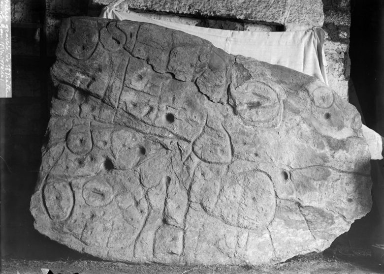
The Saint-Belec slate, a 4,000-year-old map, is considered the oldest known depiction of Europe. Discovered in northwestern France over a century ago, it remained forgotten until its rediscovery in 2014. This article explores the history, significance, and recent discoveries surrounding this unique artifact.
Discovery of the Map
The Saint-Belec slate was first found in 1900 by a local landowner in the commune of Leuhan, in the Finistère department. However, it wasn’t until 2014 that researchers led by Yvan Pailler recognized that this was not just a simple stone slab but instead a complex map with markings depicting geographical features and the locations of ancient architectural monuments.

Analyzing the Map
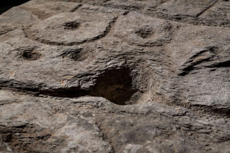
Research indicates that the map covers an area of approximately 630 square kilometers (240 square miles). By studying hydrographic features and the positions of ancient sites depicted on the slate, scientists determined that it likely represents a region in northwestern France. The accuracy and detail of the map are astounding, suggesting a high level of cartographic skill during the Bronze Age.
Significance of the Map
The Saint-Belec slate is more than just an artistic object; it highlights the mapping capabilities of our ancestors during the Bronze Age. Insights gained from this map have led to the discovery of previously unknown ancient sites and settlements, providing a deeper understanding of the social and economic dynamics of the time.
Ongoing Research and Preservation
Research into the Saint-Belec slate is ongoing, utilizing advanced technologies such as 3D scanning and digital modeling. Scientists are working to identify specific settlements and trade routes represented on the map. Additionally, proper preservation efforts are crucial to ensure that this cultural heritage is protected for future generations.

Conclusion
The Saint-Belec slate serves as a vivid testament to human ingenuity and development during the Bronze Age. Discoveries from this map enrich our understanding of the past and remind us that the stories of our ancestors are far from complete. There is still much more to uncover and learn from valuable artifacts like this one.