Table of Contents
ToggleIntroduction
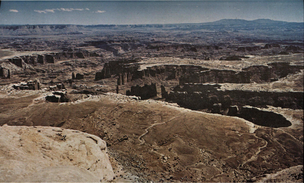
The Grabens of Canyonlands National Park are among the most striking and well-preserved geological formations in the world, bearing witness to the Earth’s tectonic and sedimentary history over millions of years. Located in the remote Maze District of Utah, these grabens are deep trenches and raised plateaus that form a unique and complex landscape. Stretching approximately 25 kilometers (16 miles) with depths ranging from 25 to 75 meters (82 to 246 feet), they invite geologists, historians, and nature enthusiasts alike to delve into the forces that shaped the region’s dramatic terrain.

Geological Origins: The Formation of a Unique Landscape
The Role of an Ancient Inland Sea
The origins of the grabens can be traced back nearly 300 million years, to a time when a shallow inland sea covered much of the American Southwest. This inland sea gradually evaporated and deposited thick layers of evaporites—salty minerals left behind after seawater evaporates—along the basin floor. Over many millennia, the thickness of these evaporite deposits grew to over a thousand meters in some locations. Alternating periods of submersion and exposure added new layers of limestone, sandstone, mudstone, and siltstone on top of the evaporite, creating a sedimentary “layer cake” of rock in varying shades of red, white, gray, and brown. These sedimentary layers would eventually form the geological foundation of Canyonlands.

The Sliding Salt Layer: The Catalyst of Salt Tectonics
At the heart of the grabens’ formation is a process called salt tectonics, driven by the properties of the soft, salt-rich evaporite layer beneath the sedimentary rock. Unlike the rigid sedimentary rock layers above it, salt is plastic under pressure and behaves much like a viscous fluid over geological timescales. As tectonic forces caused the landmass to shift and slide toward the canyons, the salt layer acted as a “sliding” base. This movement caused the brittle layers above it to fracture, creating long, parallel blocks of land that either sank or rose, forming the grabens.
The Visible Legacy: Modern Views of Ancient Processes
A View from Above: Satellite Imagery Captures the Grabens
On May 13, 2014, the Operational Land Imager (OLI) on Landsat 8 captured a stunning view of Canyonlands’ grabens, showcasing the intricate structure and vivid hues that characterize this geological marvel. The images, created by Jesse Allen and Robert Simmon of NASA Earth Observatory using data from the U.S. Geological Survey, reveal the ancient, jagged terrain shaped by salt tectonics and tectonic activity. These images have provided scientists with invaluable insight into how salt layers and sedimentary rock formations interact over vast time periods, further illustrating the intricate balance between structural forces and erosion.

Erosion’s Role in Shaping the Grabens
Erosion has continued to sculpt the grabens over millennia, exposing deeper layers of rock and reshaping the landscape in subtle but powerful ways. Wind, rain, and temperature fluctuations gradually wear down the surface, deepening the trenches and exposing even older rock layers, which reveal more details about the Earth’s geological past. This erosion has made the grabens accessible to researchers, offering clues about the region’s climatic history and how geological forces have transformed the land.
Scientific and Visitor Interest: A Living Textbook of Earth’s Dynamics
Canyonlands’ grabens offer one of the most accessible and well-preserved examples of salt tectonic formations in the world, providing a rare opportunity for both scientific study and public appreciation. Geologists study this area to better understand how salt tectonics shapes landscapes in similar regions globally. For visitors, the grabens provide a chance to explore and marvel at an ancient natural process visible on the Earth’s surface—a phenomenon usually hidden deep within the Earth’s crust.
Conclusion
The grabens of Canyonlands stand as a testament to the dynamic forces that have shaped the Earth over hundreds of millions of years. This region, with its trenches, plateaus, and striking geological formations, embodies the interplay of salt tectonics, tectonic pressure, and natural erosion. As one of the world’s best-preserved examples of ancient salt tectonic activity, the grabens continue to captivate and inspire those who visit, bearing silent witness to the powerful, unseen forces that continue to shape our planet.

